Tonghou: Complete Guide to the Tonghou Traversing Trail in Taiwan
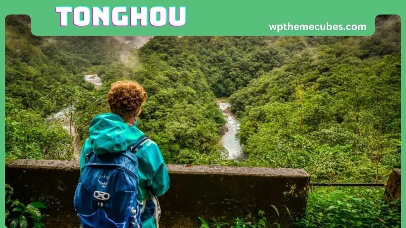
Tonghou is one of the most interesting mountain destinations in Wulai District, New Taipei City, Taiwan. Best known for the Tonghou Traversing Trail, the area combines forest scenery, mountain streams, Indigenous history, and a quieter hiking experience away from the busy streets of Taipei.
The trail is located in the mountains behind Datong Mountain and forms part of an old route associated with the Atayal people. The official Taiwan Forest Recreation website describes it as one of the historic mountain routes used by the Atayal people of Wulai for hunting and travel between mountain areas. Today, the same landscape attracts hikers who want to experience Taiwan’s natural environment in a more peaceful setting.
The Tonghou Traversing Trail is about 7 kilometers long, with an elevation range of approximately 450 to 730 meters. It is officially rated Level 2 and is intended for the general public, although the trail surface is described as a primitive mountain trail. The official recommended planning time is about half a day to one day.
For visitors from the United States, Tonghou can be an especially appealing destination because it offers a different view of Taiwan. Instead of focusing on city attractions, shopping districts, and crowded tourist sites, a visit here brings travelers into a forested mountain landscape shaped by water, weather, history, and local culture.
What Is Tonghou?
Tonghou is the name commonly associated with the Tonghou mountain area and the Tonghou Traversing Trail in Wulai District.
The official name is Tonghouyueling Trail, while English-language travel sources may use names such as Tonghou Traversing Trail or Tonghou Mountain Crossing Trail. In Chinese, the trail is written as 桶後越嶺步道.
The name Tonghou is connected with the area’s location behind Datong Mountain. The official forest recreation information explains that the name refers to the area behind Datong, or “big bucket,” mountain.
What makes Tonghou special is the combination of natural and cultural features.
Visitors can experience:
- Mountain forest
- Tonghou Creek
- Small waterfalls and rapids
- Rocky stream areas
- Historic mountain routes
- Atayal cultural heritage
- Seasonal vegetation
- Mountain scenery
- A quieter environment away from central Taipei
Tonghou is therefore more than a simple hiking path. It is a landscape where nature and history are closely connected.

Where Is Tonghou Located?
Tonghou is located in Wulai District of New Taipei City, Taiwan.
The trail is part of the mountain environment between the Taipei area and Yilan. The official Taiwan Forest Recreation system places it in the Beitao Mountain Area and lists its elevation between about 450 and 730 meters.
Wulai is already well known as a mountain destination south of Taipei. It is famous for its hot springs, waterfalls, Indigenous culture, forests, and scenic mountain surroundings.
Tonghou takes visitors farther into this natural environment.
The location is one reason the trail feels very different from an ordinary urban hiking route. Once visitors move deeper into the Tonghou area, the surrounding landscape becomes increasingly dominated by forest, streams, and mountain terrain.
For travelers staying in Taipei, Tonghou can be considered a mountain excursion rather than a quick city attraction. Transportation requires planning, particularly because ordinary vehicles are not freely allowed along Tonghou Forest Road.
Tonghou Trail Facts and Difficulty
The official trail information gives Tonghou a Level 2 hiking classification. It is described as suitable for the general public, but the route should still be treated as a genuine mountain hike.
The main facts are:
Also Read:Growth Navigate Funding: Complete Guide to Startup Financing and Investor Success
- Trail length: about 7 kilometers
- Elevation: about 450 to 730 meters
- Elevation difference: about 280 meters
- Official difficulty: Level 2
- Recommended duration: half a day to one day
- Trail surface: primitive mountain trail
- Entry permit: not required
- Mountain system: Beitao Mountain Area
- Managing office: Hsinchu Forest District Office
- Geologically sensitive area: yes
The relatively low elevation does not mean that the trail is completely effortless.
The official classification should be understood together with the trail condition. A primitive mountain trail can include uneven surfaces, rocks, roots, mud, and slippery sections.
For an experienced hiker, these conditions may be manageable. For someone who rarely hikes, Tonghou may feel more demanding than a paved recreational trail with the same distance.
A good rule is to prepare for Tonghou as a natural hiking route rather than as a casual sightseeing walk.
Natural Scenery and Tonghou Creek
The natural scenery is one of the biggest reasons to visit Tonghou.
Tonghou Creek moves through the mountain landscape and creates a variety of water features. Official information describes rapids, short waterfalls, pools, and shallow stream areas along the route.
This gives the trail a changing character.
Some sections are dominated by trees and forest shade. Other areas bring visitors closer to the creek. Rocks and flowing water create natural viewpoints, while higher sections provide a different perspective of the surrounding mountains.
One of the best ways to enjoy Tonghou is to avoid rushing.
Instead of treating the 7-kilometer distance as something to finish as quickly as possible, take time to observe small details.
Look at the way water moves around rocks. Notice moss and ferns growing in damp areas. Watch how light changes under the forest canopy. Listen to the sound of the creek when the trail moves close to the water.
These small experiences are a major part of Tonghou’s appeal.
History and Atayal Heritage
Tonghou has a long cultural history connected with the Atayal people.
According to the official forest authority, the route was historically used by Atayal people for hunting and was one of the three major mountain-crossing trails used by the Atayal community in Wulai.
This history gives the trail significance beyond recreation.
Modern hikers may see a forest path and think of it as a place for exercise or photography. Historically, however, mountain routes such as this one had practical purposes. They connected people with hunting areas and other parts of the mountain environment.
That perspective is important when visiting Tonghou.
The trail should not be viewed only as an outdoor attraction. It is part of a cultural landscape with a long relationship between people and the mountains.
Respecting this history also means avoiding damage to old trail features and treating the surrounding environment carefully.
Getting to Tonghou
Transportation is one of the most important parts of planning a Tonghou trip.
From Wulai, the official route directs visitors toward Xiaoyi Village and Tonghou Forest Road. However, Tonghou Forest Road is subject to vehicle control. The official policy is described as “controlling vehicles but not people.”
Ordinary cars, minibuses, and coaches are not freely permitted to enter.
Pedestrians and certain non-powered vehicles can use the road, while exceptions are made for official vehicles, emergency vehicles, eligible local residents, and approved transportation related to hiking access.
This means visitors should not assume they can simply drive a rental car to the trailhead.
The official system allows certain taxis and multi-purpose taxis to provide access for hikers after the required application and approval process. This arrangement helps reduce the amount of time hikers would otherwise need to walk along the forest road.
Transportation should therefore be organized before the hike rather than treated as a last-minute detail.
Best Time to Visit Tonghou
Tonghou can be visited in different seasons, and each season offers a slightly different experience.
Summer can highlight the area’s streams and lush vegetation. The sound of running water can make the forest feel cooler and more refreshing.
Autumn has a different appeal. Near the mountain pass, large areas of miscanthus can move in the northeastern monsoon winds, creating one of the area’s distinctive seasonal scenes.
Spring can be pleasant for forest walks and vegetation observation, while winter provides cooler hiking temperatures.
However, season alone should not determine your decision.
Mountain weather matters more than the calendar.
Also Read:Dashboard Anywhere: The Ultimate Chrysler Employee Portal Guide
Heavy rain can make the trail slippery and can change stream conditions. The official guidance specifically tells pedestrians to pay attention to safety and avoid the area during rainy periods.
For that reason, the best day to visit Tonghou is a day with suitable weather and current trail conditions, not simply a day in a preferred season.
What to Bring for a Tonghou Hike
Tonghou does not require an expedition-sized backpack, but basic preparation is important.
The official trail information recommends light equipment, including water and a small amount of food.
A practical day-hike setup can include:
- Drinking water
- Small snacks
- Comfortable hiking shoes
- Lightweight clothing
- Rain protection
- Sun protection
- Insect protection
- Small first-aid supplies
- Fully charged phone
- Power bank
- Offline map or GPS information
- Waterproof protection for electronics
- Any personal essentials
Footwear deserves special attention.
Because the trail is described as primitive, shoes with good traction are preferable to smooth casual footwear. Wet rocks, mud, and uneven ground can make walking more difficult after rainfall.
You also do not need to carry unnecessary equipment. A lighter backpack can make a long walking day much more comfortable.
Safety and Trail Conditions
Safety should be one of the first considerations when planning Tonghou.
The official trail database identifies the area as geologically sensitive and notes concerns related to landslides and slope movement.
The trail is also connected with a stream environment, so rainfall is particularly important.
A mountain stream can change quickly after heavy rain. Water that looks calm at one moment may become faster and deeper later.
Visitors should therefore avoid entering dangerous water, climbing unstable rocks, or approaching slopes simply for a better photograph.
Basic safety practices include:
- Check official trail information before leaving.
- Check the weather forecast.
- Avoid hiking during heavy rain.
- Wear shoes with good traction.
- Carry enough water.
- Keep your phone charged.
- Stay aware of your surroundings.
- Do not ignore warning signs.
- Leave enough time for the return journey.
- Turn back when conditions become unsafe.
A successful hike is not measured only by reaching the end. Knowing when to change plans is also part of good mountain judgment.
Wildlife, Plants, and Photography
Tonghou is a strong destination for visitors who enjoy observing nature.
The official trail system includes species observations through iNaturalist, reflecting the area’s ecological interest.
The forest provides opportunities to notice plants, insects, birds, moss, ferns, and other forms of life.
You do not need specialized equipment to enjoy this aspect of the trail.
A phone camera can capture many details, especially when you slow down and look closely.
Good subjects include:
- Stream reflections
- Water flowing over rocks
- Forest paths
- Ferns and moss
- Tree textures
- Small waterfalls
- Mountain vegetation
- Miscanthus in autumn
- Mist and changing weather
- Natural light under the forest canopy
Try not to disturb wildlife for a photograph.
Avoid chasing animals, touching plants unnecessarily, or entering restricted areas to get a better angle.
The most valuable photographs are those that record the experience without damaging the environment.
A Practical One-Day Tonghou Plan
A simple Tonghou trip can be organized around preparation, transportation, hiking, and return travel.
Start by checking the official trail status and weather conditions.
Next, confirm how you will reach the trailhead. Because ordinary vehicles are restricted on Tonghou Forest Road, this should be arranged before departure.
Once at the trailhead, walk at a comfortable pace.
The official route description identifies several points along the 7-kilometer route, including the Tonghou Suspension Bridge trailhead, Shuangxikou, an abandoned suspension bridge area, a junction near Hongludi Mountain, the mountain pass, and the final trailhead.
Allow time for photographs and short breaks.
Also Read:VPSRus: Complete Guide to the Former Hosting Provider
Do not plan the day so tightly that a small delay becomes a major problem.
Finally, keep your return transportation in mind. A beautiful mountain hike can become stressful if visitors reach the end without enough time or a clear plan for getting back.
Responsible Travel and Common Mistakes
Tonghou’s natural character is part of its value, so visitors should help protect it.
Carry all trash out of the mountains. Stay on established paths where appropriate. Do not remove plants, rocks, or historical objects. Keep noise low and avoid disturbing wildlife.
There are also several common planning mistakes.
One is assuming that a 7-kilometer trail is automatically easy.
Another is assuming that a personal car can reach the trailhead.
A third is ignoring rain because the weather looks good in Taipei.
Another mistake is focusing only on the hiking route and forgetting transportation back.
Visitors should also avoid relying entirely on old travel blogs. Mountain access rules and trail conditions can change.
The official Taiwan Forest Recreation system should be checked shortly before the trip because it provides the most relevant information about route details, restrictions, and current conditions.
Final Thoughts
Tonghou remains an appealing mountain destination for travelers who want to experience a quieter side of Taiwan.
The official trail information currently lists Tonghouyueling Trail as a 7-kilometer Level 2 route with an elevation range of approximately 450 to 730 meters. Entry permission is not required, but vehicle restrictions apply to Tonghou Forest Road.
The official information also describes the route as a primitive mountain trail and identifies the surrounding area as geologically sensitive. Visitors should therefore check current conditions and weather before starting their journey.
What makes Tonghou memorable is the combination of experiences.
You can walk through a forest, follow the sounds of a mountain creek, observe wildlife and plants, learn about Atayal history, and experience an old mountain route that once served purposes very different from modern recreation.
For international travelers, especially those coming from the United States, Tonghou offers an opportunity to see Taiwan beyond its major cities and famous tourist attractions.
It is not the easiest destination to plan, and that is part of its character.
With sensible preparation, suitable footwear, reliable transportation, respect for local history, and careful attention to weather, Tonghou can become one of the most rewarding nature experiences near the Taipei area.
Frequently Asked Questions About Tonghou
Is Tonghou a mountain or a trail?
Tonghou can refer to the wider mountain area, but most travelers use the term when discussing the Tonghou Traversing Trail, officially called Tonghouyueling Trail.
How far is the Tonghou trail?
The official trail length is about 7 kilometers.
Is Tonghou suitable for beginners?
Tonghou is officially classified as Level 2 and is intended for the general public. However, its primitive mountain surface means beginners should have reasonable fitness and prepare properly.
Do you need a permit for Tonghou?
The official trail information says an entry permit is not required. Transportation restrictions on Tonghou Forest Road are separate from hiking permit requirements.
Can you drive to the Tonghou trailhead?
Ordinary vehicles cannot freely enter Tonghou Forest Road. Approved transportation arrangements may be available for hikers, subject to the relevant application and access rules.
Is Tonghou good for photography?
Yes. The creek, forest, rocks, waterfalls, vegetation, and mountain scenery provide many natural photography opportunities.
Can you swim in Tonghou Creek?
Visitors should not assume that the creek is always safe for swimming. Water levels and currents can change after rainfall, and rocks can become slippery.
How much time should you allow for Tonghou?
The official recommendation is approximately half a day to one day, with one day suggested for route planning.